Map of Syros Island
Back to the main site of Syros Island
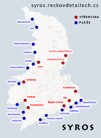
Syros: map of resorts and beaches
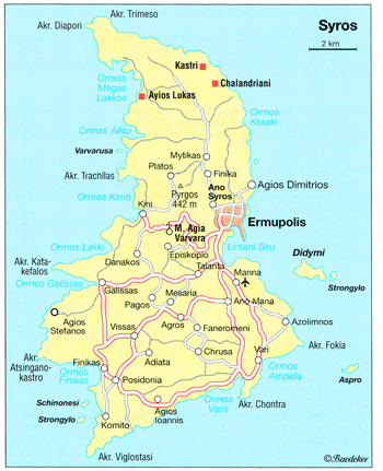
Syros: basic road map
Map of Syros with the basic roads. In the south basically all roads are passable, in the north many roads are unpaved.
Maps of Syros on the internet
| Syros map including contour lines and landscape | Syros map with a few beaches and historical sites |
 |  |
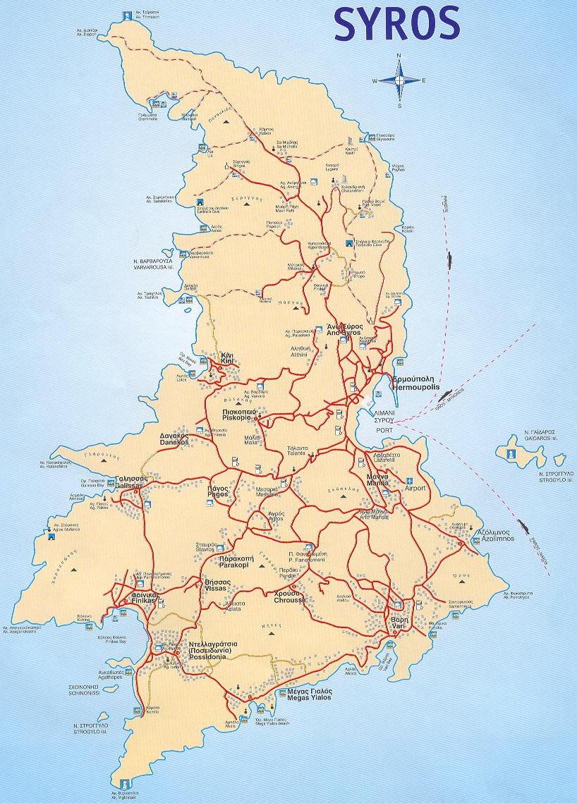
| This Syros map is showing lots of the unpaved roads in the north of the island | Syros Map with a well visible part of the island |
 |  |
Maps of other Greek islands
Andros Map , Attika Map , Erikoussa Map , Chalkidiki Map , Chios Map , Ios Island Map, Ithaka Island Map , Kalymnos Map , Karpathos - Map of resorts and beaches , Kefalonia Map , Corfu Map , Kos - Map of resorts and beaches , Crete Map , Kythira Map , Lefkada - Map of resorts and beaches , Lesbos Island Map , Limnos Map, Meganissi Map , Mykonos Island Map , Naxos Map , Olympic Riviera Map , Parga Region Map , Paxos Island Map , Peloponnese Map , Rhodos - Map of resorts and beaches , Samos Island Map , Santorini Map , Skiathos Island Map , Skopelos Island Map , Syros Island Map , Thassos Island Map , Zakynthos Map
Back to the main site of Syros Island
Read also:
List of sites